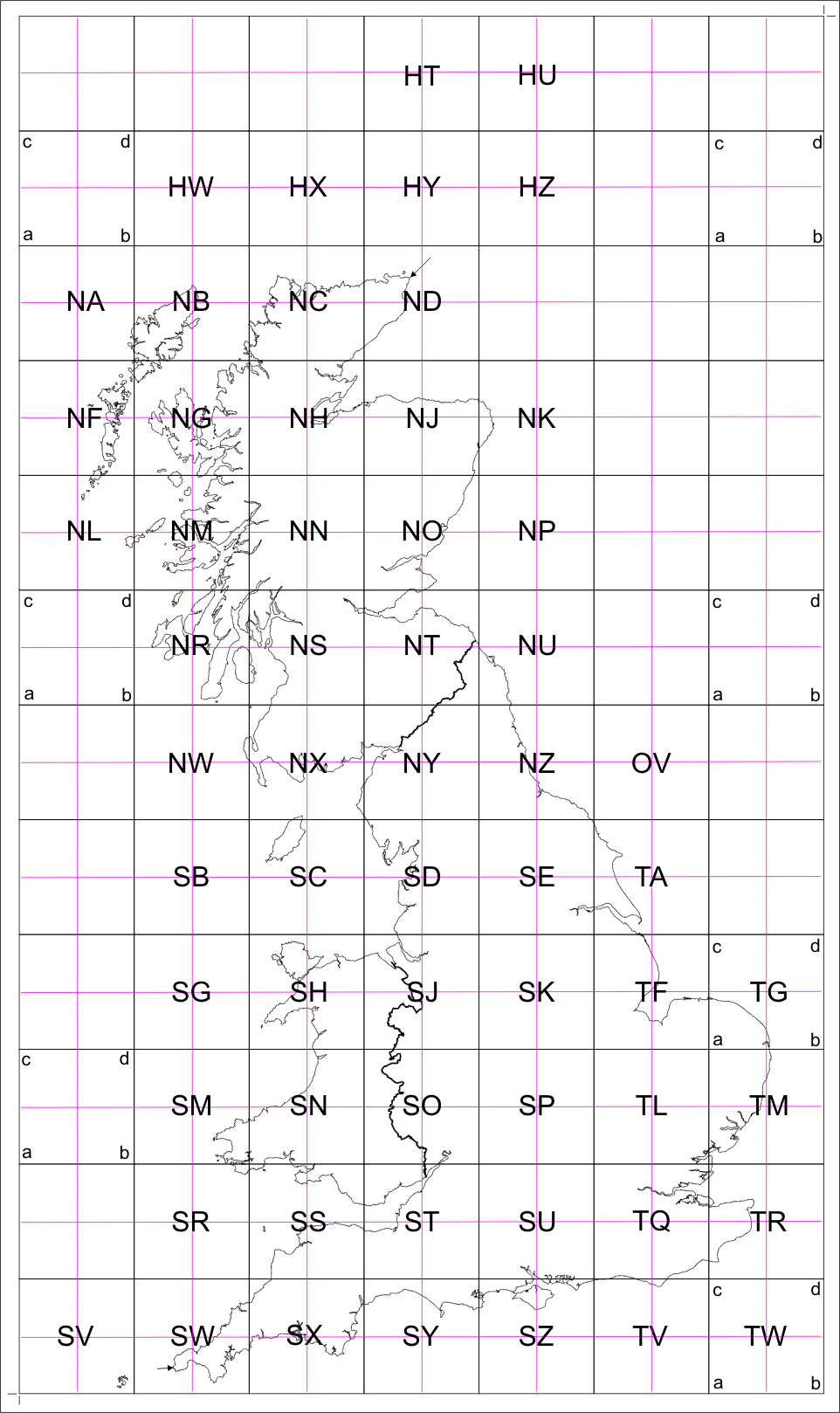
Top Level Map
Each major square in the map below represents a 100x100 km
area according to the UK Ordnance Survey grid square system. All the maps are
from the UK OpenData scheme and are open source.
The top level maps break each square into 4, 50x50 km maps provided as a 2x2 m
pdf document. For example, the TQ square is represented by TQ-a, b, c and d.
Click into each smaller square to open each map.
Sufficient resolution is provided to zoom in on screen, giving the equivalent
of a 1:5000 scale map or 400 pixels per km.
If the browser pdf reader is unable to cope with the map size, download and
open the pdf in an external reader such as Adobe.